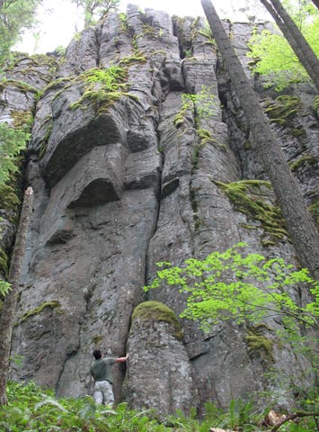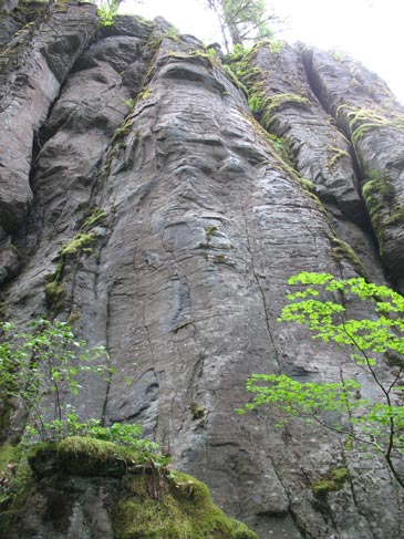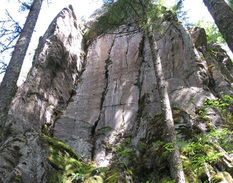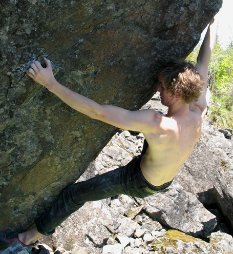
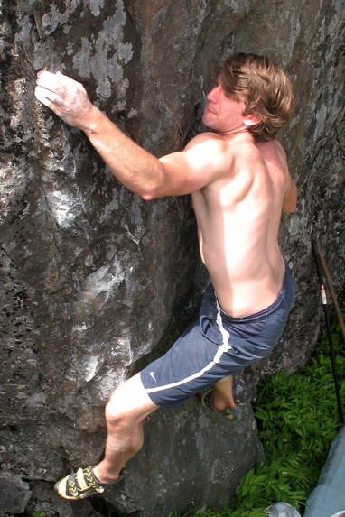
The Hunchback Wall is nestled quietly in a tantalizing tall Douglas fir forest which invites rock climber's to a uniquely stellar little vertical 100’ high wall (and nearly 500’ long) composed of a quality blend of Andesite rock. The technical nature of the rock climbs tend to keep the place as a specific interest west side Cascades site primarilly suitable for experienced hard core face climbers, and crack climbers who are well honed at long, stout, sustained climbing. The site has a plethora of steep rock swaths of smooth face sections (some with moss) that often make very powerful leads ranging from 5.10 to 5.13. The cracks luckily can be clocked in at moderate ranges from 5.9 to 5.11 but are generally long and sustained in nature (and often very wide).
The place is convenient in its near proximity to Portland (1 hour drive) and paved road access to the parking site. A 24-minute uphill hike on a reasonable path, though due to the distance from the paved road, the site will likely keep certain individuals at away. Hunchback Wall is situated in a wonderfully serene locale, sitting amongst a forest of tall 180’ fir trees, never getting the direct blazing hot sunshine as other crags do. A gentle breeze generally keeps the place comfortable even on hot summer days (we have been there even when its 90°) when other places are simply too muggy. This is a place where the sounds of nature predominate; no highway noise, and no boom box noise; instead you will find a quiet setting designed for those who relish quiet back woods climbing while still seeking high-end technical enduro rock climbs.
Full detailed beta for Hunchback Wall is in NW Oregon Rock book and the Oregon Rock & Boulder book.
Route Technicalities: The face climbing routes are very technical and highly demanding of skill. This type of Andesite has some fluted vertical features, or a pattern of box-shaped very flared closed seams on a flat face that require entire relearning a new spectrum of technique just to master the seam flares which are so prevalent. The crack climbs tend to be very long, sustained, and usually wide (2” to 12”), and sometimes quite flared. This mix makes for some really entertaining highly skilled climbing with a full range rack of gear. The popular sections to date are generally the left (north) end of the Notre Dame Wall, and the impressive South End Amphitheater overhanging alcove.
A Brief History: The site was initially explored by Don Gonthier, Craig M. and friends in the early 90s. Craig and Don referred to the place as the Hunchback secret. Upon arrival during their first exploration of the crag, they couldn't believe the scope of the massive wall. They recruited several buddies, but kept the place in general secrecy. Some additional early partners were Clif and Justin. Don also invited several other folks to the cliff to join the adventure. Some of the friends in this original crew cut the original rough path all the way up to this wall, using a deer trail for minor portions of the approach hike. They climbed a few routes, partly rap cleaned 1-2 other lines, and rappeled down other sections of the bluff. They kept the place quietly to their crew, though their energy in developing the site rapidly faded, and so the crag remained off the radar until a later generation of climbers explored the place and found it suitable for their needs.
Notes about the upper tier: When using the grassy midway terrace be ware of climbers at the base of the wall. Though the sloped terrace is quite grassy, there is some loose rock material which can endanger folks standing at the base of the cliff. Most of the rock climbs are designed to end below the lip of the main cliff, thus avoiding the mossy, gravelly steep dirt slope of the midway terrace. By placing the anchor on the steep face 10’-15’ below the terrace it avoids displacing excessive amounts of dirt and moss and keeps the terrace in a virgin like state.
Route development: Route development requires patience because the cracks and face options are long and tend to be a bit mossy and dirty in places. Often the route will be much harder than it appears, so if it seems like it might be a 5.10- anticipate it being a 5.10+. The stoutest potential for face routes at Hunchback is probably about 5.13-, and so far even the thinnest sweeps of rock seem to be quite climbable for dedicated power climbers. Fixed gear (bolts) are a common necessity if you plan to develop a new rock fat pig of metal, and power equipment up that bloody long uphill trail, so you will need lots of energy to do this day after day.
Other Site Nuances: There are some odd locals who have swiped quick-draws and ropes off the routes and belay anchors, so leaving carabiners or other gear hanging loose at the cliff will likely vanish in the interim. No person (including rappelers) should venture upstairs onto the upper central buttress while climbers are at the base of the wall without direct communication between parties. Those persons hiking up to the midway sloped ledges to set up new projects will need to remain in close contact with their partners below so everyone safely steps back from the locale of your new project (loose rock risk). The vertical upper tier cliff is an impressive steep headwall buttress reaching an additional 100’ higher above the lower 100’ of main cliff that climber's use, but mixing the two tiers together (people on the ground and climber's on the upper tier) is exposing everyone to potentially serious problems (increased rock fall risk).
How to get there: Drive east on U.S. 26 from Sandy, Oregon till you reach Welches. Turn south at the Subway store onto Salmon River Road (NF2618). Continue about 9/10 mile south passing a guardrail on the right and a small rotten roadside bluff on the left, then a deeply cut water ravine exists also on the left. Park immediately on the west side of the road at a minor pullout. Step into the dry waterless ravine for a few yards, then angle up right onto the south slope into a grove of cedar trees. A faint path begins there and zigzags gently uphill, and gradually steepens for the remainder of the hike. The uphill hike is 24-minute approach time to reach the base of the wall so pace your hike well to avoid a sweaty over exuberant experience getting up there.
Services: The nearest gas station is in Welches, Oregon.
Amenities: Welches has a grocery store, several outdoor sports shops (skiing oriented), golf course, and a resort. Rhododendron has a grocery store, and a fast-food eatery (DQ). If you drive to Sandy, Oregon you can find several higher-end exotic restaurants.
Camping or Lodging: McNeil Campground is a popular fee camping site located on NF1825 (toilet, firepit). Some free car camping spots exist on side roads like NF18, and NF1825 a few miles south of French's Dome. Various lodging facilities exist in Welches (a resort), in Sandy, and in Government Camp. Bed & Breakfast arrangements do exist in various locales along the U.S. 26 highway corridor (check the internet).
Administrative Agency: On land managed by the U.S. Forest Service.
Seasonal factors: The site is at 2650' elevation, and it is viable for climbing for about 6-7 months of the year. The crag is west-facing and nestled deeply in a forested setting with minimal direct sunshine.
Road access conditions: Paved road.