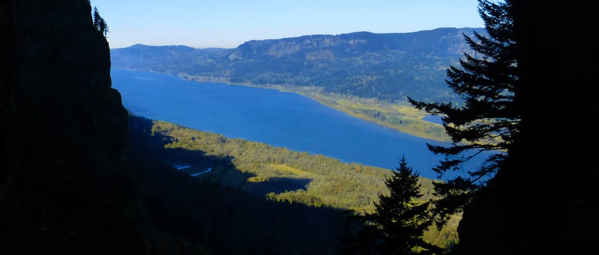
An exuberant adventurous scramble with a wide array of variables, from stout uphill hike, to an off-trail adventure foray downhill along a narrow wooded ridge crest precipice requiring some technical rappelling experience. A “trail” it is not, as its more of a pure off-trail bushwhack involving steep exposed narrow ridge crest descending and poison oak infested, rough bouldery talus slopes near St. Peters Dome. Its combination of hike, technical rappelling, down scrambling, and the finalê ascent of Little St Pete's lends to the unusual appeal of this quasi-adventure gambit in the heart of the Gorge. This odd complex mix of adventure climbing touches well on the overall diversity of the Gorge, yielding some quality photographic scenery, touring through tall whispering fir trees enveloped in gray foggy mist, dancing past the golden glow of vine maple trees, and the looming abruptness of the proverbial rarely climbed cultic monster St Peters Dome.
Getting There:
Drive east on I-84 freeway from Portland, Oregon and take exit #35 at Dodson. Proceed back west on the old scenic highway U.S. 30 for approximately 1.5 miles and park at the Horsetail Falls parking site.
Specifications:
- Rock of Ages (ROA) trail is a steep non-maintained path
- Mystery Trail (MT) is a steep technical cross-country ridge spur scramble (it's not a trail !)
- Difficulty: Exposed 3rd class ridge crest with some 5th class rappels
- Average distance uphill about 2.25 miles one way
- Elevation gain from parking lot to the upper start of the Mystery Trail: 3100’
- Average time uphill is 2½ hours (on ROA)
- Average distance downhill (on MT) is 2 miles one-way
- Average total time round-trip: 6 hours
- Total miles round-trip: 5.50 miles
- High Point: 2,690' elevation
- Difficulty: high challenge
- Seasonal factors: year-round, but best from Spring to Fall season
- Fees or Regulations: day use parking fee: Northwest Forest Pass
- USGS Map: WGS84 10T 75000E 49000N general region
- Guidebooks for this and other off-trail adventures: Gorge Classic Climbs
- Additional Notes: some folks have done this adventure from bottom up (though nowadays its not common)
There is one common book source for information and beta to this climbing site: Gorge Classic Climbs
Equipment:
A single 60-meter rope, helmet, rappel device and harness, good boots, slings, carabiners, and perhaps a walking pole or ice axe for stability.
The Rock Of Ages trail (ROA) is a great hike and surprisingly popular, but is also a very steep Gorge forested ridge hike. It is a classic scramble with tremendous elevation gain along a dramatic and picturesque ridge line. To the left are sweeping views of the Gorge, while on the right are the vast depths of Horsetail Creek. Whether during the summer, or on a stormy winter day, this hike offers variety both in grandeur and extent unrivaled in the Columbia River Gorge.
Start at Horsetail Falls trail #438 and hike up the well-graded trail as it zigzags uphill for ½ mile until you first begin to see the upper falls (Ponytail Falls). Approximately 200’ before the primary hiking trail loops under the upper Ponytail falls, you will find a path branching steeply up to the left into the forest. An old sign nailed to the tree at the start of this trail says, ‘not maintained’. This is the infamous Rock of Ages trail.
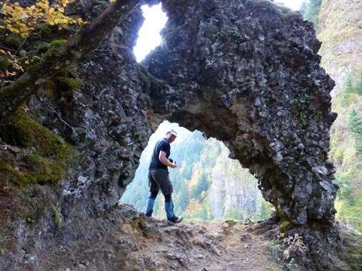
After you have done the initial warmup on the first ½ mile of the main Horsetail trail you are ready for the real stuff. So begins the adventure, a stout surprisingly steep uphill scramble on a roughly worn path known as the Rock of Ages Trail (ROA). The trail begins steep and stays continuously steep up to the 2500’ level with a mix of rootball grabbing, slick slope slithering, hands on groveling experience. At roughly the 800’ level the path splits, the main going right, and another smaller path going left. Take the narrow path to the left (northward for .2 mile) along the ridge crest to a small ROA natural rock arch that offers superb views of the Columbia Gorge to the east. Reverse course back to the path junction, and continue on the main ROA south uphill trending path. This path trends horizontally south momentarily then uphill past a deeply cut north-facing ravine and notch (that looks down back toward the rock arch).
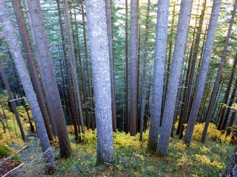
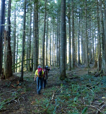
Midway up (about 1 mile) the ROA the path breaks out into the open along a brief narrow basaltic rim called the Devils Backbone. This spot makes a good rest spot to take in the scenic views and a quick photo of the Gorge. This second portion of the ROA hike gradually changes to an open forested mystic scene of Hemlock-Spruce-Doug fir mix, good for Chanterelle hunting while en route to your real prize.
Continue up steep terrain passing several short rock outcrops. Its at these minor outcrops that the upper leg of the virtually invisible Russ Jolley Trail lands (if you can find it). Shortly above the outcrops the trail begins to level out onto the Palmer plateau. Continue to hike southeastward on this upper plateau for about ½ mile in a mixed forest canopy with an open forest floor covered by minimal growth of ferns, bear grass, and mahonia. Stop when you reach GPS point UTM NAD83 10T, 574564, 5048333, 2690' elev (or Degrees-Minutes NAD83 45.58425, -122.04383). An old cedar tree with a skinny metal tag bearing the imprint “Mystery” used to clue us in as to the beginning point of the Mystery Trail. Now its up to your GPS unit, or your sixth-sense exploratory intuition.
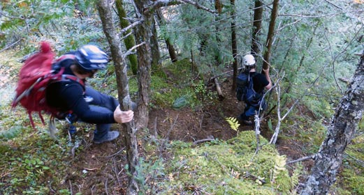
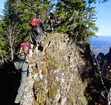
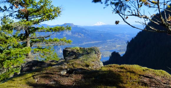
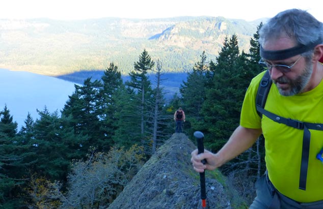
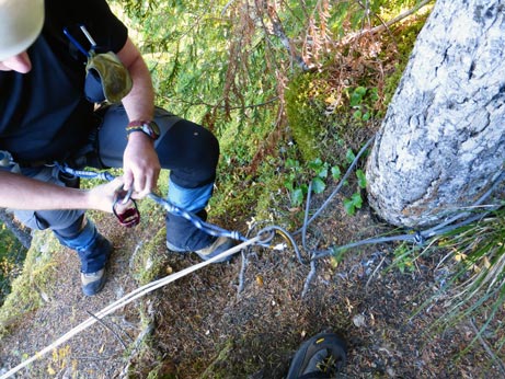
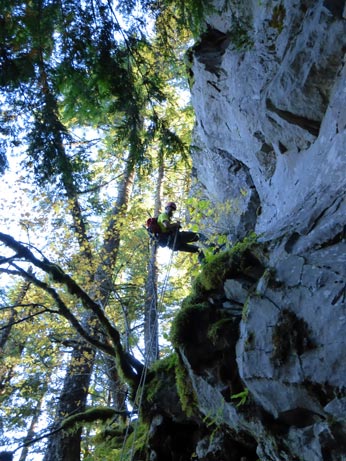
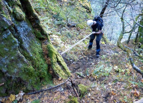
The Mystery Trail branches off the ROA to the north at the 2810’ level approximately. The trail is a thin track heading north from a cedar tree in a forest full of cedar trees. Walk north a few minutes along this trace. Soon the path will begin to drop steeply to a rappel point (at the 2,810' elevation). Rappel 70-feet to a ledge, and then descend through a tree blow down area (or rappel 1-2 more brief short steps) while staying near the ridge line. The route gradually becomes quite apparent along the skinny wooded ridge crest. The ridge crest stays steep and often exposed in places. Exercise caution while descending. At about 2000' you will briefly dance along a flat rock crest (a good place for a brief snack break), then down more steep 4th class terrain. At 1600’ level the path levels off in a group of tall fir trees and seems to fade out. A hidden “names” register exists here near a tree. A deer path crosses the crest here and descends down westward into Dodson creek (can be used if you are desperate for an alternate Plan B escape route).
Ultimately, though, most adventurers continue downhill aiming north toward the outline of St Peters Dome. As you near the top of a vertical band of cliffs you will be peering directly across at the infamous St. Peter’s Dome. As you angle downhill and slightly eastward, you will find in an open talus slope a large fir tree with a rappel sling around it. If you have two ropes you can rappel from this tree down a fat steep ravine to a ledge system. If you only have one rope you will need to scurry downhill a bit further and locate a smaller tree to rappel from that will function well for a 60-meter rope. Once you are on the ledge system walk off east along this brushy ledge onto a broad open boulder talus field next to the Little St. Pete’s pinnacle.
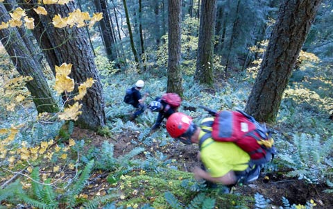
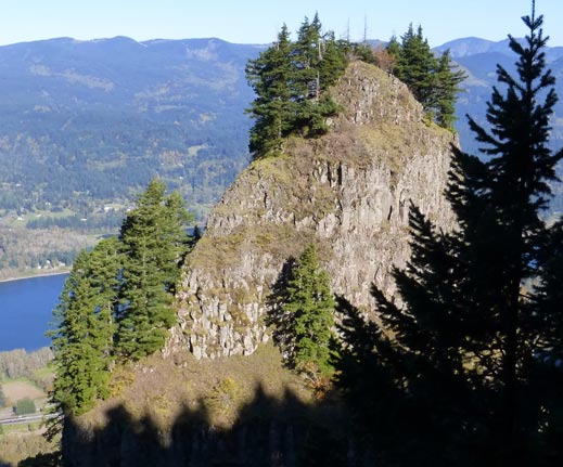
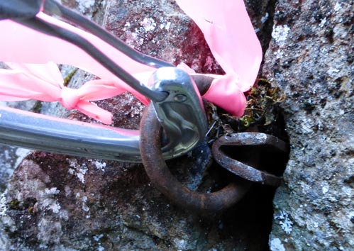
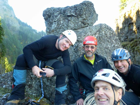
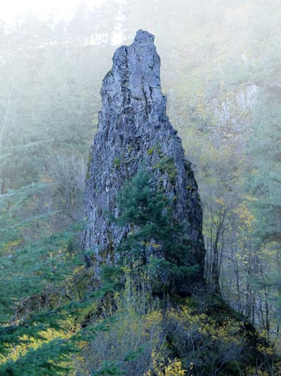
When you reach Little St Pete's throw your packs down, get some lunch, and harness up again. The bold leader can power up the 5.5 climb for 60' to the summit of Little St. Pete's, though the pro is a bit sparse (e.g. 2 fixed pitons). Belay your friends up to the top for a summit photo-fest and a chance to gaze across at the beast, the real St. Peters Dome. This little pinnacle is a worthy finalê for this fine adventure.
Now that you are done touring around viewing and photographing at St Peters Dome area, pack it up and head west, descending downhill on a poison oak infested steep and loose talus bouldery slope down westward into the Dodson creek. As you near the creek you will need to angle northward to avoid the abrupt drop into the creek (caused from a landslide some years ago).
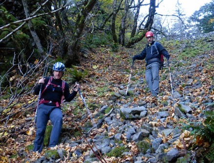
Descend down to the creek, and follow in the creek bed (or next to it) continuing downhill till you find a single switchback of the Nesmith Point Trail #428 where it briefly touches the stream. Jump onto the trail and follow this trail downhill for the remainder of the distance to U.S. 30 old scenic highway and trailhead. Walk west for 1.5 miles passing exit #35, and passing the Ainsworth State Park campground till you reach your original starting point at Horsetail Falls parking lot. Congratulations, you have just completed one of the wildest off-trail adventures of the Gorge.
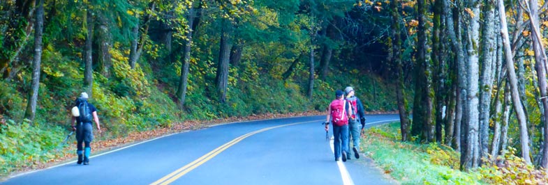
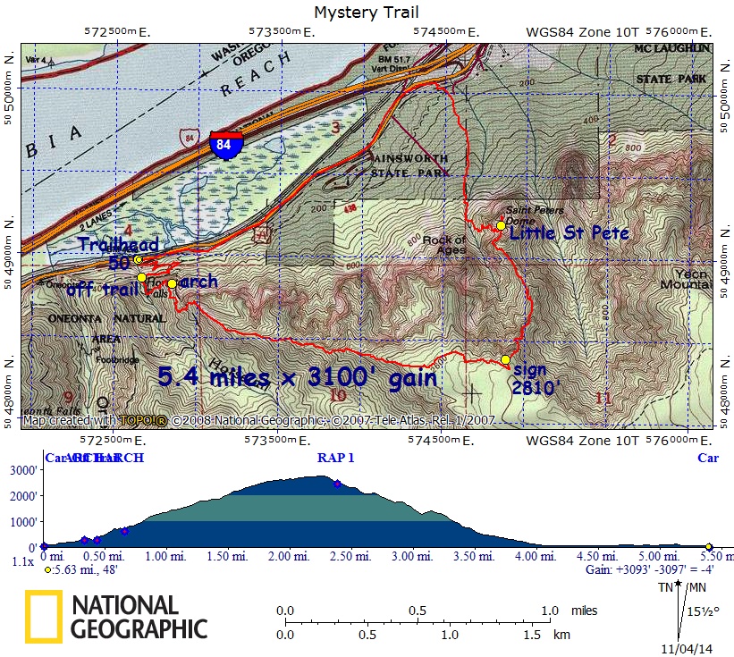
Photo and chart credits: K. Helser
